UN
1 Church Walk
£ 387,500
Description
We don't have a Description for this property.
- Bedrooms
- 3
- Bathrooms
- 0
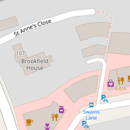


Leaflet © OpenStreetMap contributors
The heatmap indicates the level of crime in the area. The color of the heatmap indicates the crime severity and recency.
Metrics Year-on-Year
- Average area value
- 2,073,186.00 £Increased by 84.46 %
- Average area rental value
- 2,231.00 £/moDecreased by 13.73 %
- Est rental Yield
- 1.29 %Decreased by 53.26 %
- Crime Rate
- 3.00 %Unchanged by 0.00 %
from 1,123,946.00 £
from 2,586.00 £/mo
from 2.76 %
from 3.00 %
Nearby Schools
| Name | Type | Ofsted | Distance |
|---|---|---|---|
| La Sainte Union Catholic Secondary School | Voluntary Aided School | Good | 0.26 KM |
| William Ellis School | Voluntary Aided School | Good | 0.40 KM |
| Parliament Hill School | Community School | Good | 0.43 KM |
| Brookfield Primary School | Community School | Good | 0.64 KM |
| Gospel Oak Primary School | Community School | Outstanding | 0.82 KM |
Images
Nearby Streets
| Name | Average Price | Average Sqft | Distance |
|---|---|---|---|
| Boris Nemtsov Place | £ 4,500,000 | 0 | 0.00 KM |
| West Hill Court | £ 0 | 0 | 0.00 KM |
| Holly Lodge Mansions | £ 0 | 0 | 0.00 KM |
| Neurath Path | £ 0 | 0 | 0.00 KM |
| Broadbent Close | £ 0 | 0 | 0.00 KM |
Nearby Transport
| Name | NLC | TLC | Distance |
|---|---|---|---|
| Gospel Oak | 1409 | GPO | 0.77 KM |
| Kentish Town | 1553 | KTN | 1.70 KM |
| Kentish Town West | 1449 | KTW | 1.79 KM |
| Hampstead Heath | 1413 | HDH | 1.89 KM |
| Upper Holloway | 1524 | UHL | 2.29 KM |
Nearby Listings
| Address | Price | Type | Score | Distance |
|---|---|---|---|---|
| Swains Lane, Highgate, London, N6 | £ 900,000 | BUY | Unknown | 0.04 KM |
| Swains Lane, Highgate, London, N6 | £ 1,500,000 | BUY | 8 / 10 | 0.06 KM |
| Swains Lane, Highgate, LONDON, N6 | £ 835,000 | BUY | 9 / 10 | 0.08 KM |
| Swains Lane, Highgate, London, N6 6AG | £ 850,000 | BUY | 7 / 10 | 0.09 KM |
| St Albans Road, London, NW5 | £ 385,000 | BUY | 5 / 10 | 0.12 KM |
Nearby Properties
| Address | Price | Distance |
|---|---|---|
| 1 Church Walk | £ 387,500 | 0.00 KM |
| 2 Church Walk | £ 1,400,000 | 0.00 KM |
| 8a Swains Lane | £ 706,000 | 0.09 KM |
| 21 Hillway | £ 2,545,000 | 0.11 KM |
| 107 Highgate West Hill | £ 598,000 | 0.12 KM |